
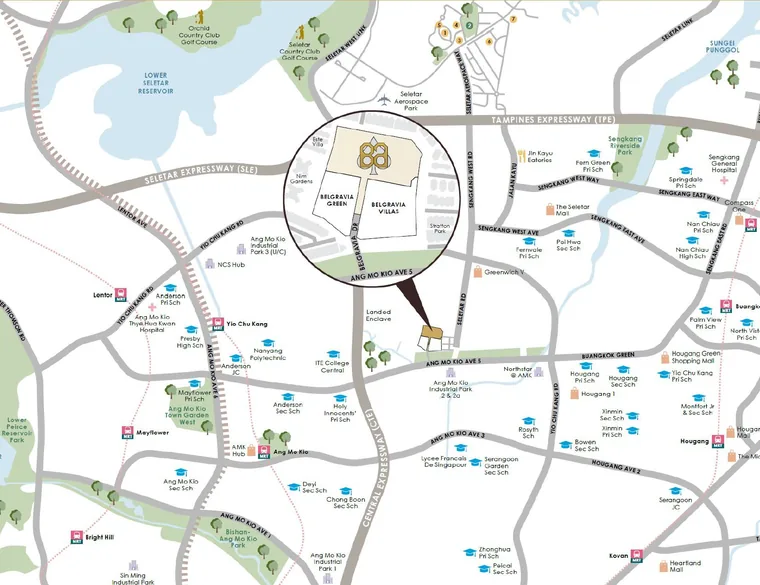
Belgravia Ace sits at 365 Belgravia Drive, a private road running off Ang Mo Kio Avenue 5 into Seletar Hills Estate, in District 28.
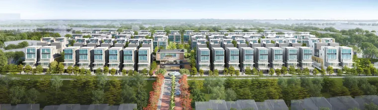
Belgravia Drive is a cul-de-sac in effect. It serves the three Belgravia phases and their landed neighbours — Nim Gardens, Este Villa, Stratton Park — and carries no through traffic. The surrounding grain is low-rise houses and mature trees, which is why the estate feels considerably further from Ang Mo Kio town centre than the eight-minute drive suggests.
District 28 is a private residential district covering Seletar and Yio Chu Kang. It has no MRT station of its own and no shopping centre inside it, and those absences are the reason the enclave has stayed quiet. Buyers who want a station at the doorstep should look elsewhere; buyers who want a landed street with no bus route running down it are in the right place.
| Expressways & city | Drive |
|---|---|
| Central Expressway (CTE) | 6 min |
| Tampines Expressway (TPE) | 10 min |
| Seletar Expressway (SLE) | 10 min |
| Central Business District | 21 min |
| Retail & dining | Drive |
|---|---|
| Greenwich V | 6 min |
| The Seletar Mall | 8 min |
| Hougang 1 | 8 min |
| AMK Hub | 8 min |
| Chomp Chomp Food Centre | 9 min |
| NEX | 11 min |
| Seletar Aerospace Park | 13 min |
| Business nodes | Drive |
|---|---|
| Ang Mo Kio Industrial Park 1 | 10 min |
| NCS Hub | 10 min |
| Seletar Regional Centre | 13 min |
| Defu Industrial Estate | 13 min |
| Punggol Digital District | 15 min |
| Nature & recreation | Drive |
|---|---|
| Serangoon Gardens Country Club | 9 min |
| Bishan-Ang Mo Kio Park | 12 min |
| Lower Seletar Reservoir | 12 min |
| Thomson Nature Park | 13 min |
| Seletar Country Club | 14 min |
Drive times are the developer’s indicative figures and will vary with traffic and time of day.
Two programmes will reshape access from this part of the island within the decade.
Cross Island Line Phase 1 is targeted for completion in 2030 — 29km and 12 stations from Aviation Park to Bright Hill, serving Loyang, Tampines, Pasir Ris, Defu, Hougang, Serangoon North and Ang Mo Kio. Teck Ghee, Tavistock and Serangoon North stations all fall within the broader Ang Mo Kio and Serangoon area. The full station list and timing is on the Cross Island Line page.
The North–South Corridor, Singapore’s longest transit priority corridor, is targeted to open in phases from 2027. The 8.8km northern viaduct from Admiralty Road West to Lentor Avenue comes first; the 12.3km tunnel from Lentor Avenue to the East Coast Parkway follows in 2029. It carries dedicated bus lanes, cycling trunk routes and pedestrian paths alongside the road capacity.
Ang Mo Kio is also designated a walking and cycling town, with a cycling path network of about 27km planned. The Ang Mo Kio master plan page covers what URA has zoned around the area.
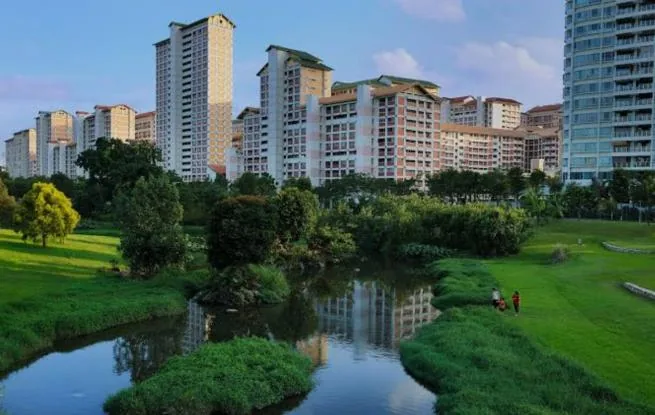
This is a location that suits a specific buyer: a family with cars, school-age children and a preference for a quiet street over a convenient platform. It is not a rental-yield play built on MRT proximity, and the pricing does not pretend otherwise. What it offers instead is a settled landed enclave with a school catchment, expressway access in three directions and two major infrastructure programmes landing within the holding period. See also the guide to Seletar Hills Estate and to the parks and reservoirs nearby.
Belgravia Drive and the streets around it read differently on the ground. Book a viewing and the Sales Concierge will take you through the estate and the neighbourhood.